Note:
The 3D map above/below shows some of the sight en route for that day’s hike. The distance always appears longer than the information below for the individual day’s hike. This is because, similar to other hikers, walkers, or pilgrims, I enjoy visiting nearby villages and towns, as well as venturing into the big city’s such as Winchester and Guildford or walking a few minutes for some outstanding views across Britain’s countryside. There are even opportunities to share a cup of tea in a church with locals
Take ascent/descent with caution, I walk off, wander, venture etc, not puist, but does give a sense.
The population is taken from the 2021 census and is based on the ‘Built up Area’ unless otherwise stated
My thoughts: The PW was now sharing much of its path with the North Downs Way where the two interchanged at various points. The Cicerone book was fairly easy to follow except it to ok us quite a bit time having to slow down to read it. The AllTrails did now have individual stages for the PW until the Way passed Otford from Southwark Cathedral leading onto Canterbury. At present there is the complete PW route from Winchester to Canterbury, but much of it leading to Otford is different from the Circerone book.
DAY 1
Start: Winchester (POP: 48,000)
Finish: Bishop’s Sutton (POP: 420)
Distance: 10.9 miles/17.5 km
Difficulty: 7/10
Total ascent: 593 ft/180 metres
Total descent: 441 ft/134 metres
Percentage paved: 52%
Route: Started from the old Roman City of Winchester at the doorstep of the Cathedral. It is possible to start at St Swithun’s Shrine from within the Cathedral, but it requires permission and a guide. As the Pilgrim’s Way follows the St. Swithun’s Way for the first 34 miles to Farnham, today’s gently undulating slopes were a good introduction for the next 160+ miles to Canterbury via London and Rochester. Within this section, there was a lot of asphalt walking through country lanes, with the remaining path walked along narrow footpaths through meadows and a couple of fields.
The first 3 miles out of Winchester were along country lanes with not a great deal of interesting things to see. It then started gently climbing over meadows and through villages. The official ending of the stage was at Alresford, but I carried on to Bishop’s Sutton for a couple of miles, where I picked up the regional bus to my accommodation in Alton. Frustratingly, there was nowhere for refreshments in Bishops Sutton (the pub had closed down), and a huge building development outside Aylesford meant that some of the roads (of which the Pilgrims’ Way ran along) were closed. Rather than trailing along the unpaved A31, I walked north towards Aylesford train line, turned right and onto Bishop’s Sutton – and it was raining quite heavily!
There were a few things to see in Winchester itself, although, being a Spring weekend, it was quite busy. Before collecting my first stamp at the Cathedral (and free ‘pilgrimage’ entrance), I visited the 15th century, Butter Cross, or city cross, a few shops which were once taverns and the architectural Victorian Guildhall with a building next door showcasing the emblems of each of the knights of King Arthur’s the Roundtable. Just outside Winchester are the ruins of Hyde Abbey, once home to 1100 monks, and further on are a couple of very pretty villages of Kings Worthy, Martyr Worthy, Itchen Abbas and Ovington, each with a centrally located church that retained some of its original stonework dating back to to 13th century. All the churches were open and each provided their own stamp for the Pilgrims’s Way passport
Accommodation:
Day 2
Start: Bishop’s Sutton (POP: in Parish 400)
Finish: Alton (POP: 18,000)
Distance: 11.5 miles/18.5 km
Difficulty: 7/10
Total ascent: 642 ft/195m
Total descent: 555 ft/169m
Percentage paved: 45%
Route: From Bishop’s Sutton, the way passes through a variety of pretty villages, moderately hilly farmlands, interspersed with visits through small pockets of woodlands. There is a lot of walking along roads with quite a few road junctions to cross, but it does, on occasion, provide breathtaking countryside views. There is very little shade or shelter from the elements, but the narrow woodland footpaths and pretty tree-arched country lanes provide some protection. This was an enjoyable stage of the way as Springtime was well and truly evident.
There seemed to be quite a lot of kissing gates, and one or two were a tight squeeze to get through, especially as farmers had reinforced some gates with additional obstacles to prevent the newly born lambs from escaping. Saying that, walking through fields with a few week-old lambs straying not too far from their mothers was a sight to behold. Being Springtime, walking through carpets of blue bells contrasted beautifully with the shaded woodlands where they grew.
The first village passed was Ropley, which is supposedly one of England’s 25 most idyllic villages. Although there is no pub, a cafe towards the end of the village provided a good cup of tea. The approach to the village of Chawton was quite magical, as there were dirt roads along what appeared as tunnels of trees, with a disused railway bridge being encapsulated with branches. In the heart of the village, there was the Jane Austen’s House museum where she spent the last 8 years of her life until she died in 1817.
As I arrived fairly late in the afternoon, I left any sights of Alton till the morning, although I did pass an unusually designed war memorial cairn before reaching Alton station for the end of the day’s walk
Accommodation: I stayed the night in Alton at an Airbnb, in a Period House run by a lovely hostess, Gill. In fact, with a couple of pubs around the corner serving great evening meals and one offering early morning breakfasts, it was difficult to start trekking before 9:00 AM!
DAY 3
Start: Alton (POP 18,000)
Finish: Farnham (POP 20,500)
Distance: 11.8 miles/19 km
Difficulty: 7/10
Total ascent: 655 ft/199 metres
Total descent: 720 ft/213 metres
Percentage Paved: 40%
Route: The route had a few easy-going undulating slopes, with a couple of moderate climbs across fields a few miles before entering Farnham. There is still a large proportion of asphalt roads, particularly in the last 3-4 miles, yet the views make up for the infrequent passing traffic. The original path’s exact course is uncertain, as many structures, including kilns and a castle, have since vanished. Consequently, the route continues to follow St Swithun’s Way.
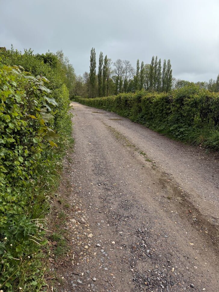
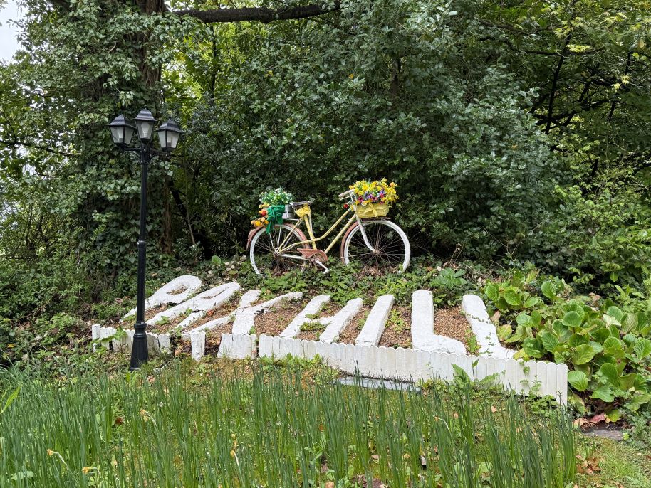
This stage of the walk was enjoyable, leading through stunning countryside, charming towns, and villages via country lanes, bridleways and wooded areas. Interestingly, there were no refreshment options directly on the path; instead, walkers had to venture a few minutes into nearby villages or towns to find cafes or pubs. The Anchor Inn, however, was conveniently located just a stone’s throw from the footpath, just outside Lower Foyle.
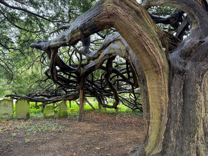
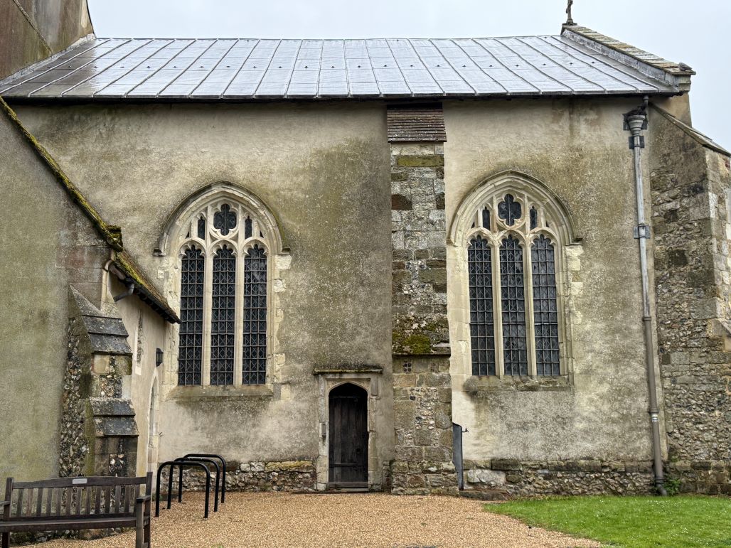
On the way, there were a couple of interesting sights. Within Alton, there was the double-nave Church of St Lawrence with Norman arches and the small (free) Curtis Museum showcasing exhibits of the town’s history. At Coldrey, there was a track that formed part of the original Pilgrims’ Way, and beyond that was Pax Hill, the former residence of Scouts founder Robert Baden-Powell. Outside Bentley, St. Mary’s Church stood out with its 350-year-old yew trees, which were propped up for support. Entering Farnham, there was Farnham Castle, which was closed at the time for renovation, but it was still possible to get up close to the walls and gates. Outside the castle were the Blind Bishop’s Steps path leading to Castle Hill (the main road). This path consisted of groups of seven steps, each separated by seven strides, which allowed the former Bishop of Winchester, Robert Fox, to navigate the route unaided despite his diminishing vision.
Accommodation: No accommodation – train back home.
DAY 4
Start: Farnham
Finish: Guildford (POP 79,000)
Distance: 10.8 miles/17.4 km
Difficulty: 7/10
Total ascent: 690 ft/210 metres
Total descent: 795 ft/242 metres
Percentage paved: 31%
Route: The PW now leaves St. Swithuns’ Way and for the rest of its route will often share the path with the North Downs Way to Canterbury. The Way exits Farnham with the NDW, but after a mile and a half, the first of many partings of both paths took place. During this stage of the PW, there is still a fair bit of asphalt walking, although it appeared to be less so than the previous three days, but there is now a greater variety of surfaces walked upon, such as sandy and hollow paths, dirt roads, bridleways and rugged woodlands. Ancient churches continue to dominate the Way’s theme, but now there are added natural attractions, interesting landmarks and occasional countryside views.
The first interesting attraction was the metal sculpture, and a sturdy carved wooden bench a little further along, indicating the start of the North Downs Way. Passing through villages of Runford, Seale, and a well-earned coffee stop at the halfway stage in Puttenham (The Good Intent pub) was a welcome break from the previous three days, where many villages were bypassed. One or two villages were classified as being in England’s prettiest, and some of the thatched-roofed cottages with Tudor and Victorian features were gorgeous. The Watts Gallery and artists’ village near Compton was also a pleasant opportunity to venture off the path, explaining many creative items for sale. There was also a great cafe there, offering many full fat cakes and pastries!
Then, of course, there was one of the highlights of the PW, the historic city of Guildford. It does deserve a few hours or even a complete day to appreciate the sights, such as the strategic fortress, a high street full of character with its 14th century Guildhall and the attached 17th century clock protruding, along with the Angel Hotel where the London to Portsmouth stagecoach used to stop and the modern Cathedral perched high overlooking the city.
Accommodation: Stayed in the City’s Travelodge, which was cheaper than Airbnbs and certainly less than other hotels. Unfortunately, it was in the Northern end of the city, 1½ from the official finish at Ye Olde Ship Inn. Still walking there provided a chance to view some of the city’s highlights.
DAY 5
Start: Guildford
Finish: Westhumble, Box Hill (POP: 590)
Distance: 13.7 miles/22 km
Difficulty: 8/10
Total ascent: 1,568 ft/477 metres
Total descent: 1,495 ft/455 metres
Percentage paved: 14%
DAY 6
Start: Westhumble, Box Hill
Finish: Merstham (POP: 9,950)
Distance: 10.6 miles/17 km
Difficulty: 7.5/10
Total ascent: 1,313 ft/400 metres
Total descent: 1,080 ft/329 metres
Percentage paved: 12%
DAY 7
Start: Merstham
Finish: Oxted (POP: 11,500)
Distance: 8.3 miles/13.3 km
Difficulty: 7/10
Total ascent: 1,121 ft/341 metres
Total descent: 905 ft/275 metres
Percentage paved: 26%
Route: 96% of the day’s walk follows the North Downs Way. It’s an undulating stage with a couple of notable steep climbs culminating in 102 steps leading down into Oxted. Much of the path is along narrow footpaths and wide dirt tracks through woodlands with the occasional visit through fields. The Pilgrims’ Way has been forsaken as it had been almost completely subsumed by the M25, in which traffic noise can be heard for much of this section as the M25 runs parallel, less than ½ a mile away.
There was a large proportion of asphalt and paved surfaces, including ¾ mile of roads around a disappointing diversion off the NDW footpaths and onto the PW. As the section was only 8.3 miles long, its appeal slowly diminished when high viewpoints such as at Caterham and Gangers Hill Woods were mainly taken up with the M25. However, on the plus side, there were long stretches through dense woodland, with numerous long, windy paths, wildlife plants, animal habitats, and quite a few uprooted trees.
There were also a couple of things to look out for, namely, the attractive houses along Quality Street and the 13th century Merstham Church perched on a hill overlooking the town, both at the beginning of the section. Also Just past Stanstead Road near the only refreshment stop along the Way (The Harrow pub) is the Whitehall Tower, a large stone folly built in 1862 by a local farmer as a memorial to his son who was killed at sea.
Accommodation: No accommodation required – day trip from London
DAY 8
Start: Oxted
Finish: Otford (POP: 3,550)
Distance: 11.8 miles/19 km
Difficulty: 7/10
Total ascent: 655 ft/199 metres
Total descent: 720 ft/213 metres
Percentage paved: 40%
Route: