Walking the epic Via de la Plata
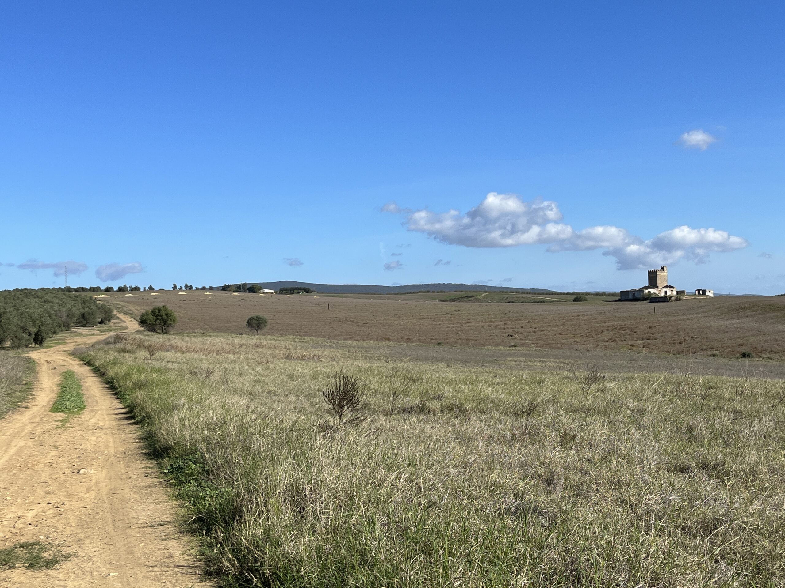
The Vía de la Plata was historically a Roman route that was used to transfer goods from the south to the north of Spain and is viewed as one of the longest and toughest Camino routes in Spain. With limited facilities, long walking stages as well as hot weather adds to its challenge. However, the path led to beautiful countryside scenery, spectacular engineering marvels, stunning medieval towns, and magnificent Roman ruins, all seen in and around World Heritage cities such as; Sevilla, Merida, Cáceres, Salamanca, Ourense and finally, Santiago de Compostela itself.
Table of Contents
Overview
My journey
Route, Terrain and Challenges
When I walked
Language
The Credencial (Pilgrim’s Passport)
Getting There and Away
Accommodation
Food and Beverages
What I packed
Baggage Transfer and Storage
Waymarking
Websites, Apps and Guidance
Route Description and Map
(Section 1: November)
DAY 1: Sevilla to Santiponce
DAY 2: Santiponce to Castilblanco de los Arroyos
DAY 3: Castilblanco de los Arroyos to Almadén de la Plata
DAY 4: Almadén de la Plata to Hotel Complejo Leo
DAY 5: Hotel Complejo Leo to Fuente de Cantos
DAY 6: Fuente de Cantos to Zafra
DAY 7: Zafra to Villafranca de los Barros
DAY 8: Villafranca de los Barros to Torremejía
DAY 9: Torremejía to Mérida
DAY 10: Mérida to Aljucén
DAY 11: Aljucén to Alcuéscar
DAY 12: Alcuéscar to Valdesalor
DAY 13: Valdesalor to Cáceres
(Section 2: May and June)
DAY 14: Cáceres to Casar De Cáceres
DAY 15: Casar De Cáceres to Cañaveral
DAY 16: Cañaveral to Riolobos
DAY 17: Riolobos to Carcaboso
DAY 18: Carcaboso to Arco de Cáparra
DAY 19: Hotel Asturias to Baños de Montemayor
DAY 20: Baños de Montemayor to Valverde De Valdelacasa
DAY 21: Valverde De Valdelacasa to Pedrosillo de los Aires
DAY 22: Pedrosillo de los Aires to Morille
DAY 23: Morilles (POP 230) to Salamanca
DAY 24: Calzada de Valdunciel to Salamanca (opposite direction!)
DAY 25: Calzada de Valdunciel to Castillo de Amor
DAY 26: Castillo de Amor to Villanueva de Campeán
DAY 27: Villanueva de Campeán to Zamora
DAY 28: Zamora – REST DAY
(Section 3: September)
DAY 29: Cáceres to Casar De Cáceres
DAY 30: Casar De Cáceres to Cañaveral
DAY 31: Cañaveral to Riolobos
DAY 32: Riolobos to Carcaboso
DAY 33: Carcaboso to Arco de Cáparra
Overview
My journey
I started the Vía de la Plata, also known as the ‘Silver Route’ in Sevilla (Andalusía), and finished in the magnificent city of Santiago de Compostela (Galicia) – over 1,000km away. Previously, I had spent a week walking from Cádiz to Sevilla along the Vía Augusta, ending at Sevilla’s cathedral and where the Vía de la Plata began. In effect, I just carried on walking!
The Vía de la Plata passes through varied landscapes, starting from the vast olives groves and vineyards of Andalusía and Extremadura, followed by extensive farmyards growing grain crops in Castile y León, and finally the green deciduous forests of Galicia. I also passed through 9 provinces: Sevilla, Badajoz, Cáceres, Salamanca, Zamora, León, Ourense, Pontevedra and A Coruña.
Around 10,000 pilgrims walk sections of the Vía de la Plata each year, 50% starting from Ourense, walking the last 112km. 20% complete the whole journey from Sevilla, and usually around 2% of all pilgrims who arrive in Santiago de Compostela complete the whole length of the Vía de la Plata.
Route, Terrain and Challenges
The official route is from Sevilla to Astorga is (735km/456miles). Its then a further 260km/161miles between Astorga to Santiago de Compostela, on the Camino Francés, totalling 995km/618miles. However, I choose to walk as far as Gran de Moreruela (619km/384miles), then headed west along the Sanabrés Way towards Santiago de Compostela, a further 375km/232miles, totalling an official 994km/617miles
On the Vía de la Plata there are many long distances to walk in a day, as much as 30-35km/18-22miles, including some on consecutive days. The route is mostly along wide dirt roads and narrow footpaths, generally away from major roads and traffic and more of slopes rather than very long steep ascents to walk along. Some days have no to limited provisions available on route (including water taps), Some villages/towns also have just 1 or 2 lodgings to choose from.
I spent lot of time with myself as company walking long distances sometimes with no town in sight for many hours. On many consecutive days, I had not passed (or been passed) by a soul. And on many evenings I was the only occupant within the lodgings. Sometimes, I would actually start talking to livestock on route, although where cattle appeared interested in what I was saying, the Iberian pigs would just run away!
When I walked
Using the ‘Average Temperature’ table below as guidance, I avoided July and August as temperatures were known to reach 40°C in the mid-section of the route and in September and October Castilla y León and Galicia were prone to cold days with some rain.

I planned to walk the over three sections. This enabled me to walk sections in warm rather than scorching hot conditions, and avoid potential difficulties in limiting my choice of accommodation due to seasonal closure. Walking in sections also gave me the chance to walk other shorter Caminos as add-ons where the climate in that region was suited good walking conditions for that time of year. From Sevilla, my three walking sections along the Vía de la Plata were:
Section 1 Day 1 – Day 12: November (Sevilla to Cáceres) + Vía Augusta
Section 2 Day 13 – Day 26: May and June (Cáceres to Zamora) + Camino Inglés
Section 3 Day 27 – Day ????: September (Zamora to Santiago) + Camino San Salvador
Accommodation
With the exception of camping, I stayed in a variety of lodgings, from basic albergues that cost very little, to a castle room that cost quite a few bucks! Many pilgrims try to stay in albergues throughout the Vía, mainly to keep costs down and use of the usually good facilities, but also these lodgings could be the only means of accommodation in that town. Personally, I can only stay for 3 to 4 consecutive nights in the albergues and then I need my own space where I would book a private room.
There are two types of albergues: municipales (run by local authority and as low as €6 a night or through donation) which I could not reserve or book ahead, usually with no heating or air conditioning, and private, (run independently), double/treble the cost of the municipale, yet booking ahead is possible. I preferred the latter of the two and they provided clean bedding, but not always towels. If bedding looked ‘suspicious’ the silk sleeping bag liner and a t-shirt over the pillow can come in handy
I started enquiring and booking accommodation a month or so prior to the walk and ensured that contacts for albergues in particular, were readily available on my phone. Some municipale albergues were not on WhatsApp, so I tended to steer clear of these for the simple reason that telephone conversations would be tricky due to my lack of Spanish! and more importantly, there would be no guarantee of a bed when I arrived. Having a contact allowed me to reserve lodging beforehand (with no pre-payment) which also helped to plan my walking stages.
Knowing beforehand the lodgings facilities helped to reduce the amount to carry, for example, I did not need to bring a towel, sleeping bag or bed sheet as all lodgings I pre-arranged provided adequate bedding facilities. I found that the private albergues tended to provide paper linen/pillowcase, or clean cotton linen, blankets, very good cooking and toiletry facilities which I might not have been guaranteed in a municipale albergue. But then I have previously stayed in excellent municipals on previous Caminos and cannot fault them. Its best to research beforehand and definitely read the reviews.
Other accommodations included; hotels, hostels, casas and apartments. Sometimes they included breakfast but my lodging choice was based on, affordability and what I needed in terms of provisions at that time, e.g washing machine, microwave, towels and linen, and distance to and from the Vía. The Castle (Day 24), was just a self-indulged treat!
I used three sources to find accommodation: booking.com (www.booking.com), Gronzo, (www.gronzo.com) and the ‘Buen Camino’ app. Based on my Vía experience, as a guide for 1 person, rates were roughly;
- Municipale albergues: donation to €10
- Private albergues: €15–€25 (could be up to €40 in the big cities)
- Hostels: €20-€35
- 1* or 2* hotels: €25–€40
- Casa: €30-€45
- Apartments: €36-€50
- Castles: €80+
Food and Beverages
Regular breakfasts tended to be a mix of sweet pastry with a croissant or toast with butter and jam. But I tended to hit the bars/cafes first thing and go for a toasted baguette with olive oil and tomato puree topped with jamon (Iberian ham) or cheese. As a mid-morning snack it has to be a tortilla slice: both meals accompanied with café con leche (coffee with milk). There were a couple of town’s where the cafes/bars did not open until 09:00 (Calzadilla de los Barros – Day 6) or even 10:00 (San Marcial – Day 26) which became slightly problematic when having to wait as there were no services further on.
By lunchtime, I would have probably finished the walk, so one or two pastries or a bocadillo (baguette sandwich) followed by a celebratory beer became the norm. However, there were a couple of very long walks that took over 8-9 hours to complete with no facilities on route, that meant preparing provisions before the walk, where a lunch and water would need to be carried, for example Villafranca de los Barros to Torremejia – Day 8 and Casar De Cáceres to Canaveral – Day 14
In the evening, dinner would comprise of a visit to a bar or to the supermarket, such as; Dia, Spar and Froiz and compile a meal using the lodgings microwave.I found that other supermarket chains either closed at lunchtime or were on the outskirts of town such as Mercadona. Pre-packed salads were good value not in just in terms of cost, but also a mental belief that I was actually balancing my diet after all the stodgy carbs eaten throughout the day! Small independent shops can be limited in choice and slightly more expensive, but sometimes, you just make do.
In every town I stayed in, there was always a bar selling food, with the exception of Castillo de Amor (Day 24) whose restaurant was way too expensive and Villanueva De Campean (Day 25), which did not even have a shop! However, other than these two, for €12 it’s possible to have a meal consisting of a main meal (e.g. burger and chips or pasta or tapas) and a couple of beers with complimentary snacks. Unlike many of the more common Caminos, I did not see menus peregrinos (pilgrim’s menu).
Weekends can be tricky. Sometimes the only shop in small towns are only open Saturday morning and closed all day Sunday. In cities and big towns, it was not a problem, but in smaller towns I had to buy food the day before and carry it with me. Facilities in the next lodging, determined what I bought. I did find that ‘Google Maps’ was really useful and reliable for the opening/closing times for 99% of supermarkets.
I had no problem drinking Spanish water, whether from fountains or water taps. Bars on route were happy to re-fill water bottles and I ensured that I never drank all the water as there was no guarantee that water was available in the next town – fountains switched off, shop closed or no bars/cafes. I did carry a few snacks to keep me going during the walks: nuts, fruit, and sugared sweets were ideal.
What I Packed
Generally, I aim to pack 10% of my body weight. Variations to the rule depend on the season, region and body size and experience as well as the ‘personal and luxury’ items. Below is a list of what I carried on the Vía de la Plata (with additional notes), but by no means should it solely be adhered to…it just suited me.
Essential items:
- 40-50 litre capacity back pack
- Rain Cover for backpack and a water proof-jacket: I have never been able to operate a poncho successfully, and I never used waterproof trousers as the walking prevents me getting cold and I do find them uncomfortable and restrictive.
- Lightweight day bag: shopping trips, strolling around towns on rest days, and for 2-3 day/night treks without requiring full backpacks.
- Walking Shoes: Lightweight/waterproof, preferably gore-tex, and thoroughly worn in prior to the trek.
- Sandals: I tended to use normal lightweight sandals for when I got to my destination and evening wear. I have never changed into sandals mid-way through a hike.
- Two quick-dry t-shirts
- 2 X long sleeved shirt (1 X quick dry and 1 X sweat shirt)
- 2 X pairs of shorts
- 1 X pair of thin trousers: light weight and cotton.
- Underwear and 2 pairs of merino socks, and 2 pairs of small ankle socks
- Sun hat
- Silk sleeping bag liner
- Reusable water bottle (I found that 1 litre bottle was enough for me as I was able to fill it up on route. However, I did take an extra bottle on the days when there were no provisions on route.
- Cap/sun cap
- Sun cream: 200ml bottle, moisturising lip balm (stick) and sunglasses
- Basic First Aid Kit; 3 sachets of rehydration treatments, anti-inflammatory cream, everyday plasters and blister plasters (Compeed), after-bite ointment, 6 X paracetamol and/or 6 X ibuprofen, and 6 X Imodium: all can be bought at any pharmacy so I never took take large quantities
- Quick-dry lightweight towel: I took the microfibre sports towel – only 35cm X 25cm
- Toothpaste and toothbrush, light razor, deodorant (plastic container rather than glass), shampoo: for body wash and washing clothes, small quantity of talcum power/vaseline (chafing).
- Small mosquito/insect repellent, and bed bug spray: had a bad experience once and have never used it since…but I never know! Reviews of accommodation do suggest how clean a place is.
- Nylon string for hanging washing and small bob pins instead of pegs to hang drying clothes,
- Small sewing kit
- Small padlock and spare key: particularly useful when using lockers in albergues
- Plastic combined: knife, fork and spoon
- A small packet of wet wipes and ALWAYS – a stash of toilet paper
- A few small plastic sandwich bags and one large bag: useful if carrying food, wet clothes or dirty shoes
- Smartphone (and camera) and external charger
- Double USB two pin adaptor (and leads for devices)
- Pouch (preferably waterproof) for; travel documents, credit cards, credential, medical IDs etc
- Lightweight head torch: ideal for early morning walking, reading and having to get up at night
- Earplugs: unless you are able to sleep through the snorers!
Personal items
Some pilgrims choose to take such things as; head net, fan, penknife, stuff sack, camera/go-pro/drone, swimming costume, umbrella or parasol, diary etc, but I took;
- Ipad: inc.kindle and books/downloads
- iwatch
- Wireless ear phones
- Lightweight selfie-stick
Considerations
- For late autumn, winter and early Spring: two season sleeping bag, cloves, scarf, woollen hat and a fleece
- Hiking Poles: um…I have never used poles, but have always been tempted in doing so. I think it is a matter of personal choice, but there is evidence that if used properly – and there is a right way, up to 30% of energy can be saved and reduction of stress on joints. I am also aware that unless the poles are in checked bags, many airlines and airports will not allow poles to be carried as on-board luggage.
Baggage Transfer and Storage
Unlike the more common Caminos, there is not an individual backpack transfer service on the Vía de la Plata until I reached Ourense (Sanabrés Way). MochilaTrans (www.mochilatrans.com) were the only company I saw advertised and tended to operate between April and October, at a cost of €5 per day/stage, payable in cash. They did transfer between Zamora and Ourense, but with a only minimum number of packs. The service works by making a request via WhatsApp/telephone (+34 629 035 774) the night before, then fill in the envelope available at the albergue/lodging stating; contact details, destination, and the money placed inside.
From Ourense to Santiago de Compostela, it is possible to use the Spanish postal service (www.elcaminoconcorreos.com), but this needs to be reserved with stages planned and all accommodation booked in advance. This service can work out to be expensive, but cheaper than local taxis, who generally view the backpack as a costly passenger!
I stored my pack for 3 days in Salamanca (www.salamancalockers.es) for €18, which was cheaper than albergues charged. This which allowed me to walk to Zamora from Salamanca with a light day pack then back to Salamanca to collect my main pack a few days later.
Waymarking
With the exception of the city Salamanca, the Vía is well signed, with traditional Camino symbols, such as yellow scallop shells and yellow arrows on a variety of places; road signs, trees, rocks, walls, lamp posts, kerbs, farmyard gates, and on the ground. There is even original Roman mile marker posts (miliarios) at various points.
Many regions had their own waymarking, e.g. in Sierra Norte (bollards), in Extremadura (stone cubes – great for sitting on during rest stops!), in Castilla y León (wooden posts). All signage is frequent, clear and when I took variations on my hike, the signage continued to be as equally as good as the main route.
Websites, Apps and Guidance
- Gronze (https://www.gronze.com) – Full listing of albergues/lodgings throughout each stage including towns within stages and nearby, with great reviews.
- Stingy Nomads (https://www.stingynomads.com) – Great information on all sorts of aspects when walking a Camino
- Camino de Santiago Forum (https://www.caminodesantiago.me/community/) – Up-to-date forum with vital information on road closures and alternative routes after heavy rainful.
- Buen Camino app – my GPS route tracker
- Booking.com (www.booking.com) – Great for booking accommodation
- BUKATY, Nicole, La Vía De La Plata and Camino Sanabrés, Cicerone, Cumbria. 2023 – Very informative about preparing for a Camino and with detailed guidance during each stage.

SECTION 1 (NOVEMBER)
DAY 1:
Start: Sevilla (POP 684,000)
Finish: Santiponce (POP 8,500)
Distance: 9.6km/5.9miles
Difficulty: 3/10
Total ascent: 55m
Total descent: 49m
ROUTE: A relatively short hike for Day 1, but I had walked from Alcalá de Guadaíra on the way to the World Heritage Site of Sevilla (17.7km) for the final stage of the Vía Augusta. By mid-afternoon it was raining lightly, but did not impede the enjoyment of walking through a great city like Sevilla (www.sevillecityguide.com)
The Vía de la Plata starts from the west face of Catedral de Sevilla (https://www.catedraldesevilla.es) at the Puerta de la Asunción towards the crossing the beautiful Puente de Triana (oldest bridge in Sevilla). The Vía then divides with a choice of two paths with only a 400m difference in length. Instead of the Camas variation, I took the official direct route to Santiponce, mainly because I had just walked a couple of hours through a city and needed a bit of countryside! The signage was very clear and easy to follow.
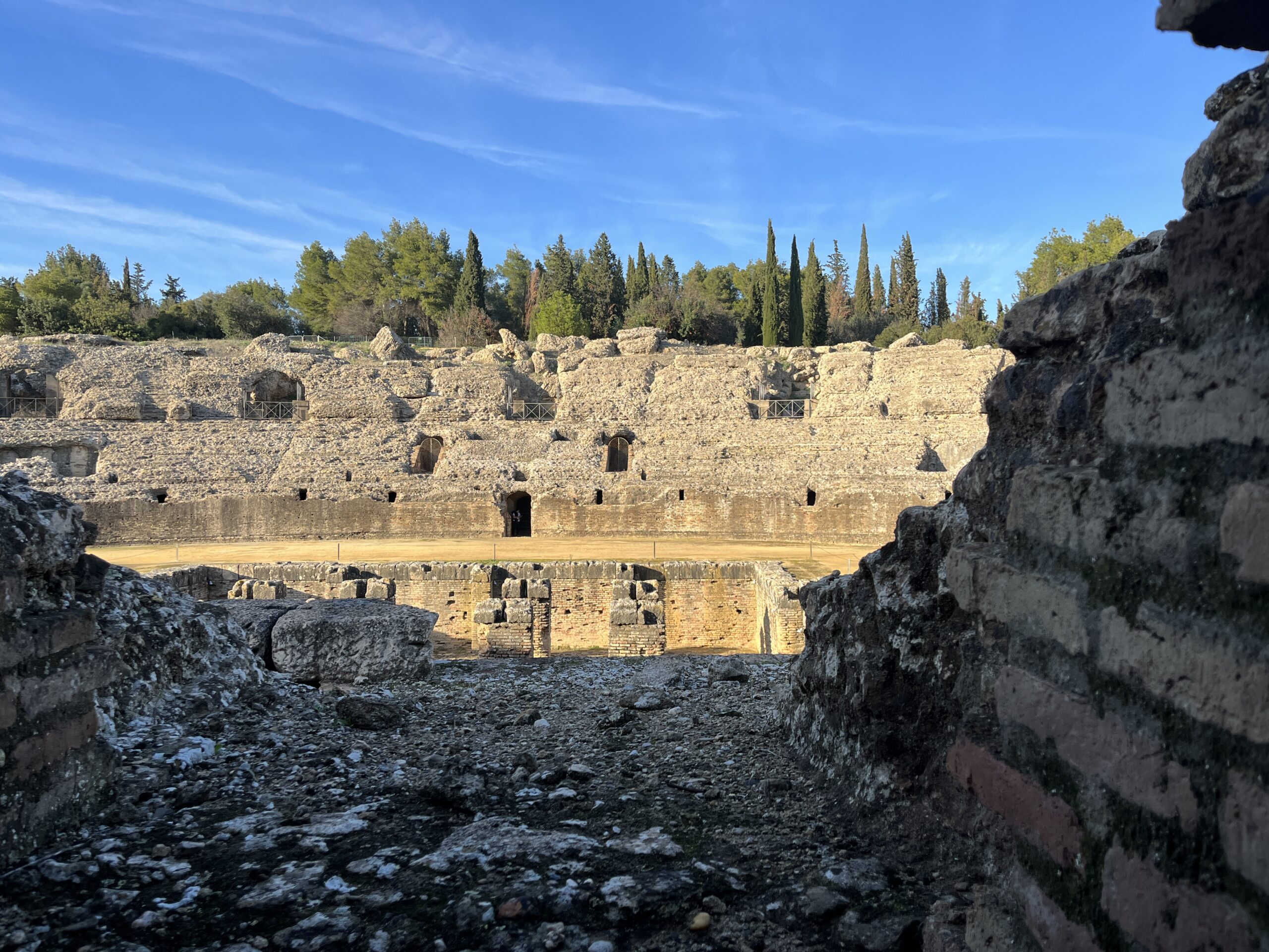
In Santiponce (https://www.spain.info/en/destination/santiponce/), there were two great sites to explore: Monasterio de San Isodoro del Campo (mix of Gothic and Mudejar styles where it is said that the first translation of the Bible from English to Spanish was made) and approximately 500m further on was the architectural site of Italica, ruins of the first Roman city in Spain, worth a visit for its; Roman baths, amphitheatre, arena, and mosaics. And, if you live in the EU – its free!
Accommodation: Italica Hostel (9.5/10). Situated in a suburb in Santiponce. Very clean with varied kitchenette utensils, excellent wi-fi and very informative about the surrounding historical area.
DAY 2:
Start: Santiponce
Finish: Castilblanco de los Arroyos (POP 5,100)
Distance: 28.5km/19.5 miles
Difficulty: 8/10
Total ascent: 450m
Total descent: 130m
ROUTE: This long stage was a good introduction to the Vía de la Plata. Long stretches through wheatfields and gentle undulations, passing grazing cattle and Iberian pigs on route. Shade was limited and there were no food/water provisions from Guillena (11km from Santiponce) onwards. There was also steady ascent to Castilblanco de los Arroyos – with an unreliable drinking water pump inbetween both towns. In August, with higher temperatures, I would imagine this would be an interesting introduction to the Vía!
From Guillena, the Vía begins to come into its own. First challenge is to decide whether the crossing over the Ford just outside town is doable; if not then a small detour would be required (both alternatives signposted). Turning left at a set of warehouses (approx. 2.5 km from Guillena) leads through a gorgeous dehasa where wildlife and woodland are specially managed so that Iberian pigs can feed on ample acorns, cattle graze on nutritious grass, and myself…on the look-out for an eagle and kestrel.
The footpath for the last 15km was more challenging as in some sections it was quite narrow and short stony steep ascents. The Vía crossed a couple of cattle grids and through some field gates, finally into Castilblanco de los Arroyos. The town provided all services/provisions I needed with lots of well stocked supermarkets (useful for tomorrow’s very long and un-serviced hike) and many mini-plazas scattered around with a bar or two on the corners.
Accommodation: Albergue La Posada de Escardiel (9/10). Very clean, shared bathroom, small kitchen, but with all facilities required for an overnight stay. Well managed by the owner who had very limited English, but an expert in using google translate! As it was a quiet time of year, I had the whole room to myself.
DAY 3:
Start: Castilblanco de los Arroyos
Finish: Almadén de la Plata (POP 1,300)
Distance: 29.5km/18.3 miles
Difficulty: 8/10
Total ascent: 589m
Total descent: 456m
ROUTE: With no facilities on route I needed to prepare breakfast and lunch, and ensured my water bottle was topped up to the full.
This stage had 2 distinct halves. The first 15km was walking along a very uninspiring road (SE-505) with a moderate climb, but then entering Sierra Norte de Sevilla at Finca El Berrocal (where very unusual stone pillars with two very large clay vessels appear), the hike developed into walking in more natural surroundings along dirt tracks and footpaths.
En route there were a few streams to cross, small bridges, and passed the ruins of the uninhabited El Barrocal Village. In addition, I also passed through many farm gates including a deer fence (at 26km) with a ridiculous number of arrows painted on it – luckily all pointing in the same direction!
Eventually, after short, undulations, and a steep 95m climb to the panoramic viewpoint at 556m altitude on the Alto del Calvario, I was treated to outstanding panoramic views where the immense scale and size of the El Berrocal Estate could be seen. After a short rest it was a pleasant 2km descent to Almadén de la Plata.
Walking through the town was very pleasing: passing decorated plazas, a few churches and recognising Mudejar influences on some buildings. There was a bullring (Torre del Reloj) and some interesting caves nearby (Cueva de los Covachos), and if I was not too knackered I would have visited at least one of them!
Interestingly, with no shade or cover, I constantly kept an eye out on the weather today as the conditions changed quite a bit – sweat shirt at 08:00, rain gear at 09:00 and tee-shirt/shorts at 10:30!
Accommodation: Casa Concha (8/10). Comfy room, clean with a reasonably priced restaurant downstairs, although wi-fi was only available in the bar downstairs.
DAY 4
Start: Almadén de la Plata
Finish: Hotel Complejo Leo (POP 0)
Distance: 25.8km/ 16miles
Difficulty: 7/10
Total ascent: 388m
Total descent: 305m
ROUTE: The walk from Almadén to El Real de la Jara (14km along) was quite enjoyable whereupon I joined with the GR48 route (waymarked by red and white signage), passed through 6 farm gates and for company I had mostly Iberian pigs sheep, oak trees and a couple of friendly dogs.
This stage included frequent slopes and beautiful pastures and forests. My favourite part of the day’s walk was walking to the brow of a hill and then being met by a herd of donkeys, goats and horses with no fences in between myself and them. Quite a meeting indeed.
There are long stretches of uneven drover’s tracks where farm vehicles have created deep groves in the path which creates an uneven terrain, but also quite muddy in places which made it difficult to create a walking rhythm.
Walking through El Real de la Jara was quite pleasant and at a good distance from Almadén for a well-earned rest, although at the tapas bar I received a rather runny omelette instead of the tortilla I thought I’d ordered – definitely need to brush up on my Spanish!
On the other side of El Real de la Jara, I entered Extremadura and said goodbye to Andalucia, but not without passing a foreboding Castillo de las Torres. There is another castle on a hilltop overlooking the town, but I did not have time to explore – although I have heard that the views from the castle gate are stunning. I continued for a very long stretch on a wide farm track passing Fincas and dehesas and always gently climbing uphill.
Eventually, 12km further on and a swift left turn, the Hermitage of San Isidoro Labrador (Isolated chapel) appeared: with strangle looking monument, more like a spaceship outside! and then on the right to my accommodation for the night.
Accommodation: Hotel Complejo Leo (8/10). A motorway service station; expensive food and refreshments. The room was comfy with a very good shower, but weak wi-fi. Too tired to venture outside, so the room did me just fine after a third consecutive long hike, and to give my right heel blister time to recover with a bit of TLC! Reception staff were very helpful in organising onward travel accommodation.
DAY 5
Start: Hotel Complejo Leo
Finish: Fuente de Cantos (POP 4,700)
Distance: 30.1km/18.7miles
Difficulty: 7/10
Total ascent: 628m
Total descent: 513m
ROUTE: Following the N-630, there was a monotonous but steady climb to begin with, but past Monesterio there were a few undulating slopes – nothing strenuous. Again, very little shade or shelter as I walked through the dehesas on long stretches of stoney paths passing farmyards, wheatfields, olive groves and vineyards. From Monesterio there no services until Fuente de Cantos (21km).
About 8km from Hotel Complejo Leo, there is a final 800m push uphill to Puerto de la Cruz, the highest point of the Camino so far. Immediately dropping towards Monesterio, passing a jamon (ham) statue, as well as the popular Museo del Jamón.
With not that much to maintain my interest, my self-reflection took a very deep and meaningful insight into two major issues that seemed to pester me throughout this stage: What makes a pilgrim different from a hiker and why do farmers place dogs in fields where sheep are kept – is it to stop thievery? Or just to scare the life out of walkers when getting too close to a field fence?
In Fuente de Cantos (famous for the birthplace of painter Francisco de Zurnarin) I found it to be an interesting town, with many clock towers and churches to explore, and to slowly stroll along the near deserted cobblestone streets.
Accommodation: Hotel Rural La Fabrica (8.5/10). Comfy beds and wooden beams/floorboards which gave a very rustic feel. Very close to a string of shops, bars and restaurants along the main artery – Calle Real, but awful wi-fi connection.
DAY 6
Start: Fuente de Cantos
Finish: Zafra (POP 17,000)
Distance: 25.5km/15.7miles
Difficulty: 4/10
Total ascent: 221m
Total descent: 287m
ROUTE: Fairly flat day’s walking, following comfortable dirt tracks through cereal farming, olive groves, vineyards and crossing a few streams. Two towns in between: Calzadilla de los Barros (6.5km) and Puebla de Sancho Pérez (14.3km further on) provided good services, although in Calzadilla I had to wait until 09:00 for it to open.
Arriving in Zafra (https://turismo.zafra.es/), was a pleasant stroll among some beautiful buildings, busy main streets and some extraordinary Moorish fortresses and archways. There are a few lovely churches built around windy narrow alleyways which gave it a distinctive old town feel, especially around Plaza Chica and Plaza Grande in the evening when the streets were lit up beautifully.
I have noticed that unlike other more common Caminos, many churches on the Vía were closed or the doors locked throughout the day except during scheduled services and maybe for an hour or two on certain days. Maybe it’s the time of year or reduced numbers of tourists, but it can be frustrating.
Accommodation: Hotel Las Palmeras by Vivere Stays(9.5/10). Superb. Location was on the corner of Plaza Grande with a balcony over-looking the gorgeous plaza. The room came with a bath, comfy bed, very good wi-fi and excellent breakfast.
DAY 7
Start: Zafra
Finish: Villafranca de los Barros (POP 12,600)
Distance: 20.8km/12.9miles
Difficulty: 4/10
Total ascent: 246m
Total descent: 346m
ROUTE: Short stage (just as well, as the hotel’s bed was so comfy and the breakfast was so tasty!) with a modest ascent to Alto de San Cristobal (named – ‘hill of the olives’, at 2.3km), continuing towards Villafranca de los Barros through a long gradual descent passing olive groves, vineyards on comfortable red clay tracks – again, with very little shade.
Weirdly, on the way into Villafranca and towards the East there appeared to be very dark clouds but no rain, and in the near distance, it looked like fog or mist which had descended on various parts of the plateau, yet the sun above was still shining brightly. Total mix of weather conditions!
About 13km into the stage a decision needed to be made whether to take the recommended route (an additional 800m via Albergue Turistico La Amazara, which is a good alternative towards Villafranca, as it allows other pilgrims to cross the A-66 safely. I took the ‘shorter’ official route where, after crossing the train tracks, carefully crossed at the bend of the A-66 – although potentially hazardous, luckily had very light traffic.
Villafranca de los Barros (https://villafrancadelosbarros.com/)is a beautiful and pleasant city to wander around; Its main monument is the church of Nuestra Señora del Valle and has many musically themed streets: in honour to the town’s nickname: City of Music.
Accommodation: Casa Perin – Hostel Rural (8.5/10). Very good, with; a handy microwave, a spotlessly clean bath, lots of space and very good wi-fi.
DAY 8
Start: Villafranca de los Barros
Finish: Torremejía (POP 2,300)
Distance: 27.3km/17miles
Difficulty: 7/10
Total ascent: 108m
Total descent: 218m
ROUTE: Another monotonous day’s hiking. This stage feels longer than it actually was – flat, and after a few kilometres from Villafranca exposure to the sun was so strong (and it’s November!). The path mainly travelled along dirt tracks and with no services en route. For company there are kilometre upon kilometre of endless withering vines and plenty of flat fields, with a 15.4km section of the same track – the longest on the Vía.
Being a very long, drawn out stage, there did need a bit of willpower and inner strength to get through it. Pleased that I prepared some snacks and had a hearty jamon bocadillo before I left. Whilst walking I kept myself busy by sorting out old photos on my phone, recording notes and spending a couple of hours texting, checking emails, even listened of some music to pass the time – it really was that sort of day.
Torremejía came into sight 8km outside the town and its one of those views where the closer you walked, it never seemed to get nearer! Arriving and walking through Torremejía was quite ‘ghostly’ – not many people to be seen and many shops/cafes closed – it was Thursday 2pm! Within town there was not a lot to see, except a 16th century parish church and the Mexia Palace House with an interesting façade, dating from 1525 scallop shells adorning the doorway arch.
Accommodation: Hostal Restaurante Milenium (7.5/10). The room in the hostel was fine (might have been the only one there) – nothing special, but warm, clean, very hot shower and good wi-fi. The bar opposite served up a great calamari bocadillo, ice-beer, and endless stream of pickles and crisps.
DAY 9
Start: Torremejía
Finish: Mérida (POP 60,000)
Distance: 16.5km/10.2miles
Difficulty: 6/10
Total ascent: 85m
Total descent: 182m
ROUTE: Today was a great little stage. Arriving in the capital of Extremadura – Mérida, founded by Emperor Augusta and becoming one of the most important settlements of the Roman Empire. The walk basically followed the flat N-630 then through fields on wide footpaths.
Weatherwise, recently there tended to be a slight mist in the morning and again late in the evening. Today was exceptional as the thick fog that descended around Torremejía meant it was going to be a late start. I could barely see one side of the street to the other. As the morning grew the mist disappeared and by 9:00am, 30 mins into the walk, it had disappeared completely.
Arriving in Mérida (https://www.spain.info/en/destination/merida/),I crossed the Puente Roman (considered the world’s longest Roman bridge) towards the main sights; Citadel, Roman theatre, Roman amphitheatre Temple of Diana and Basilica. Quite tricky to take in all the sights after a long day’s walk. Better value would have been to use Mérida as a rest day and save a lot of money by purchasing an all-day pass which allowed entry to all sights.
Strolling around the city at night was beautiful as all the ruins and bridges were lit up including the busy plazas with Christmas trees, flamingo street performers, and families enjoying the start of the weekend.
Accommodation: Hostal Senero (8/10). Well organised, clean, warm and helpful host. Allowed me to check in early. The room was quite small but for one night, it was fine, especially as the wi-fi was very good.
DAY 10
Start: Mérida
Finish: Aljucén (POP 250)
Distance: 17km/10.5miles
Difficulty: 5/10
Total ascent: 249m
Total descent: 195m
ROUTE: Just outside Mérida and from the amazing sunrise views through the Roman arches of Los Milagos aqueduct, this stage identified the start of the Vía’s Roman history such as, walking round the Proserpina reservoir and dam (6km from Merida) with excellent information boards illustrating how the Roman’s built the dam, and occasional Roman mile markers seen in the distance. The day’s walk was along gentle undulating narrow dirt paths and the return of the dehesa.
The entrance into Aljucén began at the Santiago’s cross about 1km outside and in town, there were Roman baths which Pilgrim’s could use at a discounted price. Apart from town’s plaza having a great bar serving all sorts of meals, the Iglesia de la Consolación with a Renaissance façade and prayer inscriptions on the portals had huge palm trees in the forecourt – all of which were spectacularly lit up at night.
I decided to have a bit of ‘me’ time, so opted for a private room rather than the town’s albergue (which I heard was very good), for an afternoon nap and to catch up on a bit of reading, and again…another nap!
Accommodation: Casa Rural La Plata (9.5/10). An excellent Casa; shared kitchen, room with a balcony, great wi-fi and a supermarket below (closed on Saturday PM and all day Sunday). Very clean and great cooking facilities.
DAY 11
Start: Aljucén
Finish: Alcuéscar (POP 2,500)
Distance: 19.4km/12miles
Difficulty: 5/10
Total ascent: 286m
Total descent: 109m
ROUTE: Although there were no provisions en route, today was quite a beautiful trek through the Cornalvo Natural Park among beautiful dehesas. Lots of paths lead off from one another, so it was quite easy to lose focus, but its well signposted and the Buen Camino app was a good back up. This stage had a very gentle ascent – hardly noticeable, except at the 9km, when there was a short steep climb along a pebbly path.
Not so alone today – after 1½ weeks, I met a couple of solo fellow pilgrims and it was a welcome to share Camino stories, yet alone walking as a small group on the Vía de la Plata – very rare indeed!
Being a Sunday, Alcuéscar was very quiet, although for a big town there were plenty of cafes/restaurant options in the evening. There were no significant sights to hold my attention, but the views from Ermita de la Virgen Fátima at the edge of town were amazing.
Accommodation: Rural Apartments Casa Grande de Extremadura (4/10). The Rural apartment was disappointing. Inside it smelt musky, damp and very little natural light. Along with the uneven stone floor, a wonky bed and bedside wall socket dangling on frayed wires added to the despair. Worse, being a Sunday, all supermarkets were closed, so I could not even use the kitchenette facilities!
DAY 12
Start: Alcuéscar
Finish: Valdesalor (POP 600)
Distance: 29.2km/18.1miles
Difficulty: 7/10
Total ascent: 145m
Total descent: 208m
ROUTE: Long day, as I detoured into two towns: Casa de Don Antonio and Adea del Cano. There were moderate slopes en route, but nothing strenuous. In fact, it was quite scenic with lots of open green fields and woodlands, a couple of ford crossings, and the passing of many Roman milestones, all along wide dirt tracks and narrow footpaths.
The Vía barely touched Casa de Don Antonio (8km from Alcuéscar) which turned out to be an interesting small town. I entered over a medieval bridge and into a quaint plaza with a symbolic stone cross below an alleyway leading up to a beautiful small church and a friendly café/bar which outside had a small outdoor market selling local goods. All of which to the added to the mystery of why this town was not promoted more on the walk.
Adea del Cano (7.5km further on) was a good town for lunch with its many bars, and to stock up on provisions.
Valdesalor was a strange quiet town with hardily anyone seen walking around. Had one shop which turned out to be a hotel/bar/patisserie all-in-one, and another bar opposite the main square which served up a great burger (and very cold beers) and also held keys for anyone who wished to stay in the town’s albergue – 400m away
DAY 13
Start: Valdesalor
Finish: Cáceres (POP 95,000)
Distance: 13km/8miles
Difficulty: 4/10
Total ascent: 160m
Total descent: 103m
ROUTE: A short walk, but provided more time to explore Cáceres. The first 4km followed a gradual incline along the N-630 to the top of a hill (Puerto de las Camellas) with great views over Cáceres. After, the path followed across fields on narrow footpaths and then at the edge of the City, paved roads. The last kilometre was incredible as the path passed through the old town, along windy alleyways and past a number of; historical buildings, gates, arches and large stone walls.
Cáceres (https://turismo.caceres.es/en/servicio-poi/tourism-office) is a beautiful UNESCO World Heritage City where religious architecture, palaces and noble houses reflect its Middle Ages and Renaissance past. Plaza Mayor in the old town is the focal point, but it’s the narrow cobbled side streets that require wandering for a few hours especially after entering the main gate to the historic centre – Arco de la Estrella.
Accommodation: Hostal la Rosa (8/10). Good location for bus and train station, but quite far from the old town. Virtual check-in, free tea and coffee and ‘flavourless’ pastries for breakfast. Clean and good enough for a night’s stay – good wi-fi.
SECTION 2 (MAY and JUNE)
DAY 14
Start: Cáceres
Finish: Casar De Cáceres (POP 4,500)
Distance: 13.6km/8.4miles
Difficulty: 3/10
Total ascent: 143m
Total descent: 232m
ROUTE: A late start in order to further explore the beautiful Cáceres. The short route mainly followed a flat paved road, with a pleasant walk which led through open fields, under a motorway and into Casar de Cáceres.
As this was the stage that I finished off in November last year, it did feel distinctly warmer, even when out walking in the evening, but there was still a slight breeze that made it more comfortable.
Accommodation: Albergue Rural de La Plata (7.5/10). Very spacious room, comfortable beds, good shower in a large bathroom, strange ‘iron’ balcony, but with several affordable eateries nearby.
DAY 15
Start: Casar De Cáceres
Finish: Cañaveral (POP 1,000)
Distance: 33.9km/21miles
Difficulty: 9/10
Total ascent: 409m
Total descent: 426m
ROUTE: A long, tough stage. Not only was it very hot, but there were no provisions on the way (including access to water), very little shade and the albergue at Embalse de Alcantara (20km into the walk) was closed. However, it was an interesting walk around the Alcantara reservoir – 2nd longest reservoir in Spain, where it’s possible to see; the remnants of Torre de Floripes (a fallen castle historically used as surveillance point along the Vía), barren mountains, a disused train station and a couple of picnic spots for rest and shade.
Apart from the length, there were also couple of insignificant slopes and a short steep hill at the end of the reservoir but the majority of the route was along dirt roads and stony narrow paths. The final stretch was very tough as it passed farms on paths that not only seemed to go on forever, but also wound aroundCañaveral without going directly towards it!
Cañaveral was a pleasant town which was once an important trading post. It has a couple of old churches and a nice small stone bridge that led into town.
Accommodation: Hostel Carnaveral (8/10). Set in a natural, peaceful environment, stayed in a studio flat, but had a knobbly iron spiral staircase which led to the bedroom – quite uncomfortable on the already sore feet: more so when at night trying to rush down to the toilet!
DAY 16
Start: Cañaveral
Finish: Riolobos (POP 1,300)
Distance: 21.5km/13.3miles
Difficulty: 6/10
Total ascent: 453m
Total descent: 354m
ROUTE: Today was a fairly straight forward flat walk through a beautiful dehesa towards the town of Grimaldo and beyond. In fact, the only exciting occurrence today was when I missed the Riolobos detour turn-off and walked an extra 200metres – OMG!
It was not at all dull, in fact it was very enjoyable walking through farms and being accompanied by various farmyard animals with Grimaldo providing a very pleasant rest stop.
Back on the Vía, and walking through narrow paths amongst springtime flowers in full bloom towards Riolobos – which happens to be a very sleepy and quite a long town, with an abundance of great outdoor cafes and bars, was equally enjoyable and for some reason, the hike seemed to fly by. Maybe it was just one of those days!
Accommodation: Riolobus Campground (7/10). Very nice, 2 bedroom, but with the beds quite close together. Luckily I was the only one in the room! Clean and with strong wi-fi. On site bar food was reasonably priced but no cooking facilities available.
DAY 17
Start: Riolobos
Finish: Carcaboso (POP 1,100)
Distance: 20.5km/12.8miles
Difficulty: 6/10
Total ascent: 75m
Total descent: 88m
ROUTE: As I took the Riolobos detour yesterday, it made sense to continue on a small paved road all the way to Galisteo, which was an interesting fortified town with a medieval layout, huge stone arches and whitewashed houses leading into it. It would have been really interesting to spend more time here if I had planned the Vía differently.
Unfortunately, now that I was back on the official route towards Carcaboso, it was a long drag walking on a long windy paved road – for 11km (CC-106). Not a very exciting walk; the views were no better either with large trees and roadside hedges blocking out much of the landscape. One consolation is that there were a few villages to pass through, which encouraged coffee stops and breaks in the monotony.
In Carcaboso, there was nothing that really drew my attention to, except the 6 original Roman mile markers and a pleasant walk around the hilly narrow streets.
Accommodation: Hostal Ciudad de Caparra (8/10). A great place to stay one night. Clean, adequate size room including bathtub! Good bar downstairs with exceptionally friendly staff and affordable priced food.
DAY 18
Start: Carcaboso
Finish: Arco de Cáparra (POP 0)
Distance: 18.2km/11.2miles
Difficulty: 5/10
Total ascent: 252m
Total descent: 131m
ROUTE: Wow! As opposed to yesterday’s ‘roadside’ walk, today felt like a proper hike, through glorious meadows, stepping over streams and passing through numerous farms. Along the narrow footpaths there were thousands of small frogs scuttling around searching for a pool. Avoiding them was tricky, unfortunately, some more unlucky than others!
The surprise of the day was turning around a corner full of brambles and coming face to face with the most iconic structure on the Vía – Arco de Capárra (https://www.turismoextremadura.com/en/explora/Roman-arch-of-Caparra/). Walking under the 9 metre high Roman quadriform arch and exploring the ruins of Capárra (forum, amphitheatre, baths, gates, cobblestone paving, sculptures and ceramics) placed symbolic importance to the Vía in its heyday and provided a fantastic glimpse into the past.
Luckily, having booked up Asturias Hotel beforehand, provided me with a ‘free lift’ to the hotel, 10km away – knocking off the same distance from the walk, but spending additional time venturing around the ruins was something not to be missed. More importantly, with the number of detours I have made along the route so far, crushed any guilt of hitching a lift.
Accommodation: Hostal/Restaurante Asturias (8.2/10). Small room, compact, neat, clean and tidy, double-gazed windows supported the good night’s sleep. Reasonably priced food.
DAY 19
Start: Hotel Asturias
Finish: Baños de Montemayor (POP 750)
Distance: 21.6km/13.4miles
Difficulty: 6/10
Total ascent: 434m
Total descent: 137m
ROUTE: Today’s walk provided me with three starting points in which I opted for the unofficial ‘Vía Verde’ route as it followed an old railway track through woodlands and passed two disused railway stations – better than following the official route alongside a motorway. Today also bid farewell to Extremadura and greeted Castilla y León.
From Aldeanueva del Camino (11 km away – a pretty town with a Romanesque stone bridge and intricately carved patterns on wooden balconies), the Vía followed the N-630 road all the way to Baños de Montemayor (10km further on), walking with caution as speeding vehicles zipped by.
Baños de Montemayor is a lovely spa town that is split into the new town, with cafes and bars, and the old town with pretty narrow alleyways and small plazas. However, supermarkets were particularly non-existent and the shop I eventually found had a long queue outside. Strangely, whilst walking around I did find a petrol station selling cheap beer – obviously supporting Spain’s drink-driving policy!
Accommodation: Hotel La Glorieta (7/10). Dated hotel, lukewarm hot water and basic breakfast. The room was quite small, fine for one night. Quite far from town centre and the Vía.
DAY 20
Start: Baños de Montemayor
Finish: Valverde De Valdelacasa (POP 65)
Distance: 21.1km/13miles
Difficulty: 5/10
Total ascent: 429m
Total descent: 326m
ROUTE: Today’s walk was hilly, but nothing too strenuous. However, I tended not to notice the hills, as I was too fixated on seeking out miliarios posts which marked the Roman miles – many in their original forms.
From Baños de Montemayor, the Vía followed the preserved original Roman road and at the Bejar Pass, looking behind, provided outstanding views of the departing townand the valley it laid in. After, there was a steep ascent which climbed 200 metres in less than 3km, but then the path to Valverde de Valdelacasa was through beautiful, colourful, and peaceful woodlands.
Now in the highest levels of the central Plateau in Castilla y León, it felt colder in the mornings but with greener pastures, denser forests and the Cube waymarkers have now become wooden posts with yellow arrows. The barren emptiness of the Vía seems to have passed with more frequent villages on route, and less commercial roads to walk along.
Accommodation: Albergue Valverde de Valdelacasa (9/10). A strange, but very functional hostel. Feels like as an old Victorian workhouse, with 10 beds crammed together and another 4 in the overhanging annex. The brick house room next to the bedroom has good kitchen facilities. Great terrace overlooking town, but main door is not locked! The owner runs the only bar in town and she serves up great food.
DAY 21
Start: Valverde De Valdelacasa
Finish: Pedrosillo de los Aires (POP 350)
Distance: 29.6km/18.3miles
Difficulty: 7/10
Total ascent: 580m
Total descent: 422m
ROUTE: Today was a long walk, but felt even longer. From Valverde De Valdelcasa there were a few slopes, nothing too difficult, but a constant ascent which reached 1000m in altitude.
Arrived in Valdelacasa (4km from Valverde De Valdelcasa) for breakfast and to my disappointment nothing opened prior to 9am, including the two bars in town. Not wanting to wait an hour, I carried on along a dirt road for a further 8km to Fuenterroble de Salvatierra, which had an abundance of bars/cafes and a few great sights to see – with hindsight, a regret of not staying here overnight!
After a leisurely hour of café con leches and chats with other pilgrims, I continued along some beautiful meadows on narrow tracks and grassy footpaths. I left the hills behind and the flat land ahead provided vistas of pure beauty – with not cloud in sight.
I took the variant to Pedrosillo de los Aires and it was a tough 4km uphill climb into town; not so much the ascent, but the stony path and loose rocks. It was an interesting town with the local shop opening when I knocked on the door and had a very unfriendly bar in the town centre, where patrons and owners just stared and grunted with every order I made! If pilgrim’s are looking for experiences…this is the place to come!
Accommodation: Predrosillo de los Aires (8/10). Paid by donation. Collect the key from the yellow house in the town square where the host is very kind and provides advice on where to get provisions. The room consists of 5 bunk beds – clean, tidy, and fresh linen. Good cooking facilities, although its odd that the kitchen has no sink – you need to go into the bathroom!
DAY 22
Start: Pedrosillo de los Aires
Finish: Morille (POP 230)
Distance: 11.5km/7.1miles
Difficulty: 2/10
Total ascent: 54m
Total descent: 112m
ROUTE: Today was planned as a relaxing easy day’s walk as it just followed the flat DSA-206 road, all the way into Morille. I crossed a couple of streams and passed 1 or 2 churches, but nothing held my attention.
However, Morilles was amazing! I did not expect this tiny town to provide so much to see. Around town there were unusual metal and stone sculptures and a museum cemetery with contemporary art pieces commemorating artists and significant events in history. Very interesting to spend an hour or two just wandering around town, turning corners to discover sculptures on walls, rooftops, or on top of litter bins!
Accommodation: Aparatamentos Walden by Gaiarooms (10/10). Wow! An amazing place at a reasonable cost. Slightly out of town, but worth it. Had a swimming pool, a grass terrace, spotlessly clean with comfy bed – difficult to leave before 10am next morning! A virtual accommodation with no hosts.
DAY 23
Start: Morille
Finish: Salamanca (POP 143,300)
Distance: 21.2km/13.1miles
Difficulty: 6/10
Total ascent: 207m
Total descent: 345m
ROUTE: A few slopes, but generally a very enjoyable, gradual descent into Salamanca. The path headed through the final Salamancan dehesa and now into the start of an immense Meseta of mostly flat land showing colourful farming plots and vistas far and wide.
The first half of this stage was mainly along a wide dirt road but narrowed in parts when passing through farming gates and into beautiful meadows. Then after a short swift uphill hike to Cruz del Peregrino (a large cross at 840m altitude: some would this is the half-way mark on the Vía) I encountered enticing views of Salamanca’s architectural wonders in the distance.
The walk into the city was a joy. Passing through parks, over large boulders and narrow paths, and of course the magnificent 356 metres long, 15-arched Puente Romano leading into Salamanca.
Salamanca (https://salamanca.es/en/services/on-line-tourist-office/tourist-offices) is a beautiful city. Its similar to Sevilla but on a smaller scale, with; university buildings built in the 15th century with intricately carved facades and motifs, along with the old and new cathedrals, and in my opinion, the most beautiful Plaza Mayor in Spain – especially during the night time illuminations. I think I was more intrigued with the House of Shells with more than 300 scallop shells that lined the length and breadth of the façade – incredible design.
Accommodation: Loft Puente Romano (8/10). An unusual studio apartment, with all amenities provided but everything in one room. Felt a bit claustrophobic. On the outskirts of the city but within walking distance to main sights. Clean and with great wi-fi.
DAY 24
Start: Calzada de Valdunciel (POP 670)
Finish: Salamanca (opposite direction!)
Distance: 16.7km/10.3miles
Difficulty: 5/10
Total ascent: 151m
Total descent: 155m
ROUTE: An advantage of choosing to spend two nights in one place, especially in a city, is that it provides options depending on how you are feeling. I’d planned this as a rest day, but as I had seen most things in Salamanca the previous day, today I hopped on the regional bus to Calzade de Valdunciel (€2) and walked back to Salamanca thereby ‘knocking off’ 16km of the 28km I would have had to do the following day. And…with a light day pack…I felt liberated!
From Calzade de Valdunciel, the dirt track ran parallel to the main road, which is quite visible as the Meseta continues across the plateau’s vast flat expanse, all the way into Salamanca. About 6km from the city, I walked through the suburbs, past the football stadium and into the centre – mainly on paving and following roads.
Interestingly, as I was walking in the opposite direction (south), I was pleasantly surprised to pass quite a few pilgrims heading north. Highlight of the day was stopping at Castellanos De Villiquera (5km from Calzade de Valdunciel), which turned out to be a fascinating small town with beautifully painted murals on many building and especially around the water tower illustrating pilgrimages and cathedrals.
Accommodation: Loft Puente Romano (as Day 23)
DAY 25
Start: Calzada de Valdunciel
Finish: Castillo de Amor (POP 0)
Distance: 26km/16miles
Difficulty: 6/10
Total ascent: 171m
Total descent: 251m
ROUTE: A light walking day, but the important thing is that I left my big pack in Salamanca, so that I could walk for 2–3 days with a light day pack to Zamora, and from there I would return to Salamanca to pick up my main pack.
The day started with the bus back to Calzada de Valdunciel and then followed the short trail to remote Castillo de Amor – mainly along a wide dirt road running parallel to the A-66 motorway. Rather than paying hefty prices at the Castle’s restaurant, I carried my food as there were no shops nearby and if there were, it was the dreaded Sunday, in which most stores would more than likely be closed.
There was a slight unplanned diversion (6km into the stage), where the path that I was supposed to follow directly underneath the motorway, turned into a bog! Having to walk back, I headed up on a slip road and walked along the N-630 which was a smaller road that run parallel to the A-66. At 10km took the slip road towards the Castle…and what a sight – Glorious!
Accommodation: Posada Real Castillo Del Buen Amor (9/10). Suburb. Always wanted to stay in in real castle! All the medieval features, spacious stone walled bedroom, swimming pool, moat and a drawer bridge! Wi-fi is awful, but the surroundings from every direction was just magical.
DAY 26
Start: Castillo de Amor
Finish: Villanueva De Campeán (POP 115)
Distance: 26km/16miles
Difficulty: 6/10
Total ascent: 171m
Total descent: 251m
ROUTE: After a feast of a breakfast from the castle (and a late start – 10:00am!) I set out for the long hike. The 2-3km walk from the castle back onto the N-630 was pleasant, but set the tone of the hike as it was flat, hot with not many interesting views ahead.
Today’s route basically followed a dirt road to the left of the A-66 motorway for 15km, before veering off to the more interesting path onto El Cubo del Vino. It was quite a monotonous walk as I passed 4 or 5 flyovers and with each one there was a pointless walk around the exit/entry points at the junction which seemed to make the walk even longer.
Before leaving El Cubo del Vino, I bought food provisions for this evening’s meal knowing that there were no shops/bars in Villanueva de Campeán. From El Cubo, I walked another 5km walked on a narrower dirt road alongside a disused railway line, before continuing through farmlands and into Villanueva de Campeán. Although advertised as ‘temporarily’ closed on websites, the albergue in town was actually open. This was the only albergue on Vía that I did not attempt to make contact beforehand which would have saved me quite a bit of cash as opposed to reserving the more expensive only hotel in this small town.
Accommodation: Posada Real Buen Camino (5/10). Reportedly graded as 8.5/10, but not for me! The Posada had all the homely features – clean and tidy, but I did feel like I was living in someone’s house where I was constantly being watched: not allowed to use the bath as there was cap on amount of hot water the town allows, although the room came with a bath!
DAY 27
Start: Villanueva de Campeán
Finish: Zamora (POP 61,000)
Distance: 18.3km/11.3miles
Difficulty: 5/10
Total ascent: 97m
Total descent: 184m
ROUTE: A comfortable, undulating stage. Mainly along narrow dirt roads and footpaths, through a few farms but with some tracks having very deep groves made from the heavy farm vehicles. I deviated and stopped in San Marcial for breakfast – 3km from Villanueva, but frustratingly the shop and bar did not open till 10:00am so I had to hang around for a while – I suppose I was pleased that I did not leave too early that morning.
Back on the main path and about 3km from Zamora, I passed the interesting Monoliths of Promises, which were stone structures facing inwards with inscriptions explaining the ‘peaceful’ crossroads of 3 pilgrimage paths, cultures and beliefs that converged at this point.
I then entered marvellous Zamora (https://turismo-zamora.com/contenido-idiomas.php?idioma=1). Although the Puente de Piedra was closed, the city had plenty of interesting sights, including; numerous Romanesque churches (apparently there are 23 – the most in any one city in the world!), walled gates, informative museums and wall fortifications that have survived for nearly 800 years. The Castillo de Zamora provided awesome viewsand the Catedral de Zamora, with an entrance combining Romanesque and Mozarabic styles was also very beautiful inside.
Accommodation: Hotel Puente de Piedra (9/10). Good location, clean and spacious room, very good wi-fi, bar downstairs, selection of snacks and use of microwave.
DAY 28:
Zamora – REST DAY
A well-deserved rest day with a very casual trip by bus back to Salamanca in the afternoon to collect my backpack. Returned to Zamora and continued to amble around town.
Accommodation: Hotel Puente de Piedra (as Day 27)
SECTION 3 (SEPTEMBER)
DAY 29
Start: Zamora
Finish: (POP 61,000)
Distance:
Difficulty:
Total ascent:
Total descent
k
k
k
k